Aerial Surveying
Learn more about our aerial surveying solutions to capture accurate data and high-quality imagery for a variety of applications and industries.
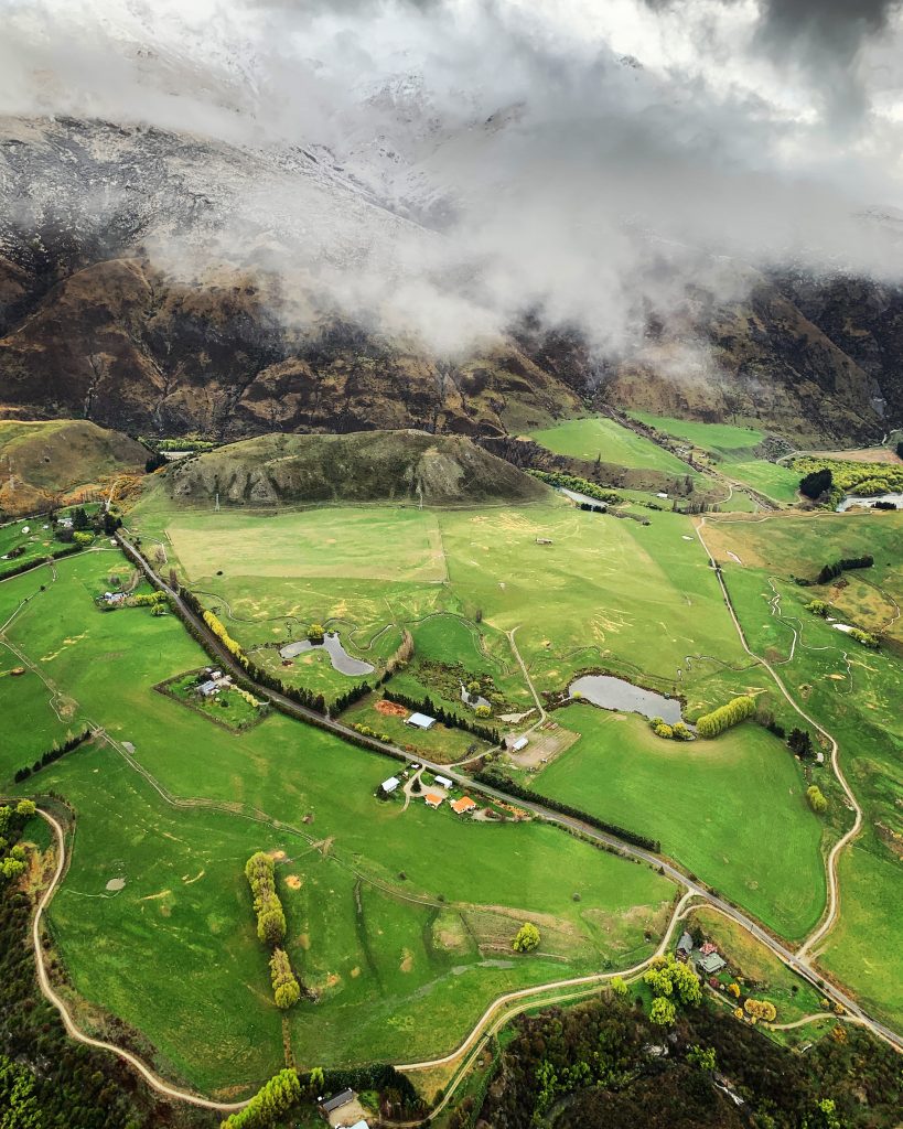
Precise Data Collection for Accurate Aerial Surveying Results
We lead the way in aerial surveying solutions, using the highest quality commercial drones equipped with the most advanced data capture technologies.
All of our drone pilots are trained professionals who possess the necessary expertise to maneuver drones and capture data with precision.
Our meticulous data analysts possess a deep understanding of data interpretation, enabling them to extract meaningful insights to generate informative reports, maps, and models.
And our experienced advisors provide you with industry-specific knowledge and expert guidance for the entire duration of your project.
Whether you need assistance in planning your aerial survey, determining optimal flight paths, or interpreting the collected data, our team is here to support you every step of the way.
What is Aerial Surveying?
Aerial surveying is a highly efficient method of gathering precise data and geospatial information using unmanned aerial vehicles (UAVs).
Through the use of commercial drones equipped with specialised sensors, aerial surveying captures a wide range of valuable data types — enabling comprehensive analysis, accurate modelling, and informed decision-making for various industries.
Advantages of Aerial Surveying Using Drones
- Extensive Coverage: Aerial surveying allows for efficient data collection of large areas to provide a holistic view of the surveyed area from an elevated perspective. It enables the collection of data from inaccessible or challenging terrains that would otherwise be difficult to reach through traditional ground-based methods.
- High Precision: With advanced sensors and technology, aerial surveying provides high-precision data capture that results in accurate measurements, detailed imagery, and precise 3D models.
- Time and Cost Efficiency: Aerial surveying significantly reduces the time and cost associated with data collection compared to traditional surveying methods. By utilizing drones, surveys can be conducted more rapidly, reducing fieldwork time and minimizing the need for manual labor.
- Safety and Accessibility: Aerial surveying eliminates the need for personnel to physically access hazardous or hard-to-reach areas. It enables accurate data collection in remote or dangerous environments such as rugged terrains, hazardous areas, or inaccessible infrastructure.
- Multi-Perspective Data: Aerial surveying offers a unique advantage of capturing data from different angles and perspectives. This multi-perspective approach enables in-depth analysis of data, accurate modeling, and better decision-making for different applications.
- Data Integration for Comparative Analysis: The data collected through aerial surveying can be integrated into Geographic Information System (GIS) platforms, allowing for seamless integration with existing data and enabling comparative analysis.
- Minimizes Environmental Impact: Aerial surveying offers a significant advantage in conducting environmentally conscious assessments by minimising the impact on fragile ecosystems. By using drones to gather vital data from above, aerial surveying significantly reduces disturbance to surrounding environments to preserve natural landscapes.
Accurate and Comprehensive Data Collection for Aerial Surveying
Our advanced aerial surveying capabilities enable us to provide you with a comprehensive suite of accurate data that allows you to gain extremely valuable insights from the surveyed area.
This includes:
- High-Resolution Imagery: High-resolution aerial imagery ensures that fine details and intricate characteristics of the surveyed landscape or objects are captured accurately, allowing for a more thorough examination and understanding of the examined area.
- LiDAR Scans: LiDAR scans rely on laser beams to measure distances and generate precise three-dimensional representations of the surveyed environment. These scans offer detailed elevation data that can be applied for tasks such as terrain modeling, volumetric calculations, and vegetation analysis.
- Thermal Imaging: Thermal imaging involves the use of infrared radiation to generate thermal images. By detecting variations in temperature, thermal imaging can help identify heat signatures, uncover energy inefficiencies in buildings, locate underground water leaks, and conduct thorough inspections of structures, assets, and equipment.
- Multispectral Data: Multispectral data is obtained by using sensors that capture information across different wavelengths of light. By processing and analysing the collected data, you can gain valuable insights to assess vegetation health, soil composition, and water quality. These insights enable informed decision-making in various fields such as agriculture, environmental monitoring, and resource management.
- Hyperspectral Data: Hyperspectral data provides highly detailed insights into the chemical composition and properties of objects or materials. This aerial surveying capability is used in applications that involve geological mapping, mineral exploration, and environmental monitoring.
- Photogrammetry: Photogrammetry is a technique that involves capturing aerial images from various angles to create precise and detailed 3D models. It enables accurate measurements, volumetric calculations, and the creation of visual representations of captured data. This method proves valuable in fields where precise spatial information is needed, such as architecture, engineering, land surveying, and virtual reality applications.
- Point Cloud Data: Point cloud data is generated through LiDAR or photogrammetry techniques, representing a collection of 3D points that accurately depict the surveyed area. Point clouds enable detailed analysis, feature extraction, and virtual reconstructions.
- Digital Elevation Models (DEMs): DEMs are high-resolution representations of the Earth’s surface to provide precise elevation data. These models are essential for applications that involve topographic mapping, flood risk assessment, and infrastructure planning.
- Orthomosaic Images: Orthomosaic images are created by merging multiple aerial photographs, resulting in a highly accurate and georeferenced representation of the captured scene. This process involves stitching the images together and applying orthorectification, which corrects distortions and ensures precise scale and alignment. The resulting orthomosaic image provides a detailed and visually consistent view of the studied region, allowing for precise measurements, detailed analysis, and informed decision-making.
- Video and Live Streaming: Video and live streaming capabilities are integral features of drones equipped with cameras. Drones have the ability to capture live video feeds or record high-quality videos while in flight. The availability of real-time or recorded video footage can assist with inspections, surveillance, monitoring, and documentation purposes.
Our aerial surveying solutions ensure the efficient capture, processing, and analysis of these different types of data, enabling you to harness the full potential of the data that is collected during our flights.
Data Processing, Analysis, Visualisation and Reporting
We don’t stop at aerial surveying and data capture.
Our experienced advisors and expert data analysts play a crucial role in turning raw data into actionable intelligence.
Combining industry experience with data processing software, we conduct in-depth analysis, extract key metrics, and generate comprehensive reports that include valuable insights and tailored recommendations.
We will walk you through the results, ensuring that you have a clear understanding of the aerial data that has been collected.
Working Drones Australia: Experts in Tailored Aerial Surveying Solutions
With our extensive experience in a diverse range of sectors, we are your trusted partner for all your aerial surveying needs.
Our team of certified and highly-experienced experts are committed to delivering outstanding results tailored to your specific requirements.
With our proven track record, industry-specific knowledge, and commitment to excellence, we have earned the trust of clients across various sectors, including:
- Government & Community
- Civil & Infrastructure
- Energy & Resources
- Emergency Services
- Natural Resources & Environment
Contact us today to discuss your unique requirements and discover how our comprehensive end-to-end aerial surveying solutions can help you achieve your project objectives.