Terrain Mapping
Discover the power of terrain mapping with Working Drones Australia. From precise topographic surveys to comprehensive land assessments, our skilled team and cutting-edge drone technology ensure accurate and detailed mapping results.
Transforming Terrain Mapping into Actionable Insights
Working Drones Australia stands at the forefront of terrain mapping solutions.
With our expert knowledge and meticulous approach, our terrain mapping solutions enable you to visualise the topography, elevation, and distinct features of your land in unprecedented detail.
Our team of certified drone pilots, experienced advisors, and expert data analysts work closely with you to ensure you receive accurate data and actionable insights tailored for your specific needs.
Sector
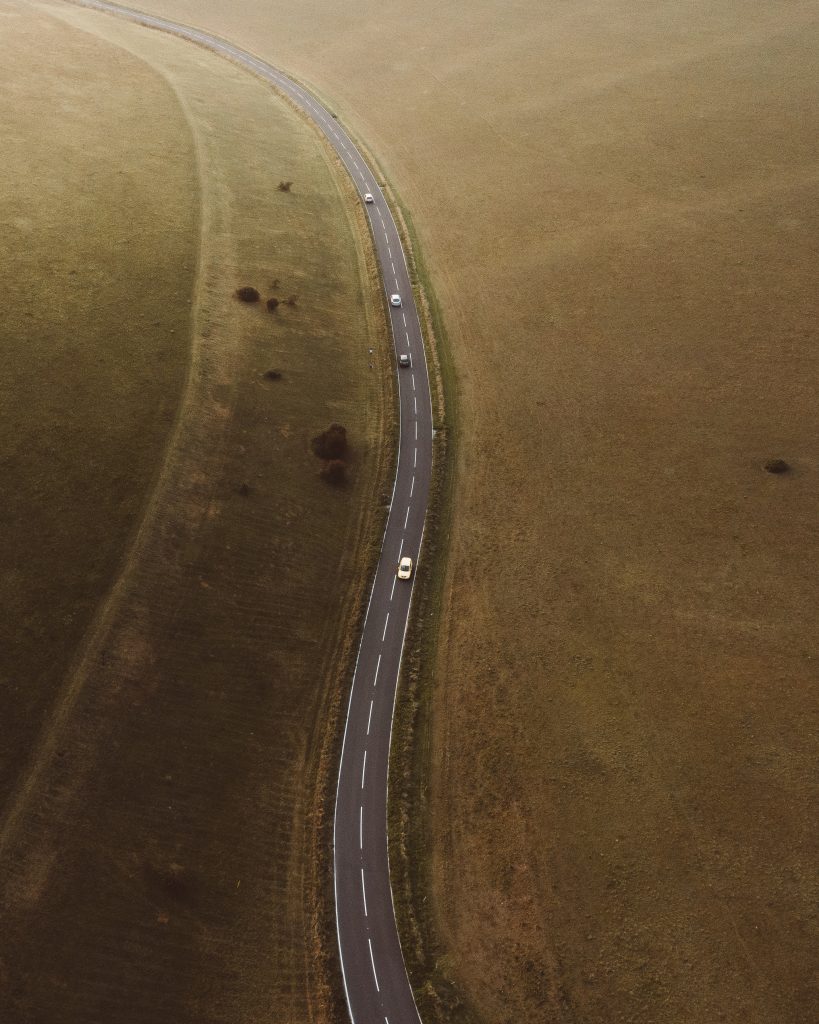
Local Government
Slope stability assessment
Experience Summary
Local NSW government client required LiDAR data to understand the slope stability of a regional road that had collapsed after significant rain
What we did
Gathered data with TrueView 535 (LiDAR)
Produced a ground classified point cloud to remove vegetation and allow for flood plain analysis
- Produced a detailed orthomosaic
What is Terrain Mapping?
Terrain mapping via drones is a modern approach to capturing detailed geospatial data about the Earth’s surface using unmanned aerial vehicles (UAVs).
Accurate and precise aerial data is captured using advanced sensors and technology, including LiDAR for precise elevation measurements, photogrammetry for 3D modelling, GNSS receivers for accurate georeferencing, and thermal/multispectral sensors for environmental analysis.
The data collected through terrain mapping undergoes thorough processing and analysis, unlocking a wealth of valuable insights that allow for informed decision-making.
Advantages of Terrain Mapping with Drones
- High Precision: Drones equipped with advanced sensors and imaging technology provide highly precise terrain mapping data. This allows for detailed analysis and accurate representation of the landscape.
- Efficient Data Collection: Drones enable rapid and efficient data collection over large areas, reducing the time and resources required for traditional surveying methods. This leads to faster project turnaround times.
- Safety and Accessibility: By conducting terrain mapping using drones, hazardous or inaccessible areas can be safely surveyed without putting human surveyors at risk. Drones can access challenging terrains, such as steep slopes or remote locations, ensuring comprehensive coverage.
- Cost-Effective: Drone-based terrain mapping offers cost savings compared to traditional surveying methods. The elimination of heavy equipment and reduced manpower requirements contribute to lower project costs.
- Versatility: Drones can capture terrain data from various altitudes and angles, providing flexibility in mapping different terrains and capturing specific features of interest.
- Real-time Data: Drone-based terrain mapping provides real-time data acquisition, allowing for on-site analysis and immediate decision-making. This facilitates prompt adjustments to project plans or identification of potential issues.
- Enhanced Visualisation: The collected data can be used to generate detailed 3D models and visualisations, enabling stakeholders to better understand the terrain and make informed decisions based on accurate representations.
Accurate and Comprehensive Data Collection
With our comprehensive terrain mapping services, we collect a variety of different types of data to gather accurate information about the surveyed terrain.
Different types of data include:
- Elevation Data: Drones capture precise elevation data, allowing for the creation of accurate digital elevation models (DEMs) and contour maps. This information is essential for understanding the topography and slope of the terrain.
- Orthophotos: Drones capture high-resolution aerial imagery, which is then processed to create orthophotos. These orthophotos provide a detailed and georeferenced representation of the terrain, allowing for accurate measurements and visual interpretation.
- Vegetation Analysis: By using specialized sensors, drones collect data on vegetation health, density, and coverage. This information aids in assessing biodiversity, monitoring vegetation changes over time, and identifying areas of potential concern, such as invasive species or forest health issues.
- Land Cover Classification: Drones capture imagery that can be used to classify different land cover types, such as forests, agricultural fields, water bodies, and urban areas. This data helps in land management, land use planning, and environmental monitoring.
- Hydrological Mapping: Drones equipped with sensors can collect data on water bodies, including rivers, lakes, and wetlands. This information assists in analysing water flow patterns, monitoring changes in water levels, and assessing the health of aquatic ecosystems.
- Infrastructure Inspection: Drones enable the visual inspection of infrastructure, such as roads, bridges, buildings, and utility networks. The collected data helps in detecting structural damage, monitoring construction progress, and identifying maintenance needs.
- 3D Modelling: Drones capture imagery from multiple angles, allowing for the creation of detailed 3D models of the terrain. These models enhance visualisation, simulation, and planning capabilities for various applications, including urban development and landscape design.
- Thermal Imaging: Drones equipped with thermal cameras capture infrared data, which can be used to analyze temperature variations across the terrain. This information is valuable for identifying heat anomalies, detecting energy inefficiencies, and assessing wildfire risks.
- Point Clouds: Drones capture dense point cloud data using LiDAR (Light Detection and Ranging) sensors or photogrammetry techniques. Point clouds provide detailed 3D representations of the terrain, enabling precise measurements, volumetric analysis, and accurate feature extraction.
- Slope Stability Analysis: By combining aerial imagery and elevation data, drones assist in analysing slope stability and potential landslide risks. This information is crucial for identifying hazardous areas and implementing appropriate mitigation measures.
Working Drones Australia ensures the streamlined acquisition, processing, and analysis of this data, enabling you to gain valuable insights for informed decision making.
Data Processing, Analysis, Visualisation and Reporting
Our expertise in terrain mapping with drones goes beyond the data collection process.
We provide comprehensive data processing, analysis, visualisation, and reporting solutions to transform the raw data into actionable insights.
To further enhance your understanding of the processed data, we provide expert consultation and a comprehensive range of visualisation materials that include detailed topographic maps, realistic 3D models, informative heat maps, and more.
Working Drones Australia: Experts in Terrain Mapping Solutions
Leveraging the flexibility and power of drone technology, our expert team delivers precise and efficient terrain mapping solutions tailored to your requirements.
From rugged terrains to remote locations, our expertise in terrain mapping allows us to navigate and capture accurate data in the most challenging environments.
With Working Drones Australia as your partner, you can expect highly efficient terrain mapping processes and expert recommendations.
Backed by extensive industry knowledge, the latest technologies, and an expert team, we have earned the trust of clients across a wide range of sectors, including:
- Government & Community
- Civil & Infrastructure
- Energy & Resources
- Emergency Services
- Natural Resources & Environment
Contact us today to discuss your specific terrain mapping requirements and discover how our comprehensive end-to-end solutions can help you achieve your project objectives.