LiDAR
Learn more about our UAVs equipped with LiDAR sensor technology for precise data capture, accurate mapping, and detailed aerial data analysis.
LiDAR sensor technology allows for precise measurements, advanced modelling, and extremely detailed data analysis — enabling you to make informed decisions with confidence.
Whether you’re mapping vast landscapes, conducting infrastructure surveys, or analysing environmental changes, our LiDAR sensor solutions offer unmatched data capture capabilities.
Why Us?
Our extensive experience with drones fitted with LiDAR technology guarantees accurate data collection and comprehensive insights you can rely on.
Contact us today to discuss your unique requirements and discover how our LiDAR solutions can help you achieve your project objectives.
Sector
NSW Government
Road of national importance
Experience Summary
- Road construction consortium needed LiDAR and Bathymetry data to plan for a bridge over a major NSW river.
- Gathered data with TrueView 535 (LiDAR)
- Gathered data with SPH Engineering dual frequency bathymetry sensor.
- Delivered a point cloud accurate to 16mm of a 1600-acre site.
- Ground classified the point cloud to remove vegetation.
- Delivered a detailed orthomosaic and reduced quality orthomosaic for planning.
- Delivered a Digital Elevation Model with contouring.
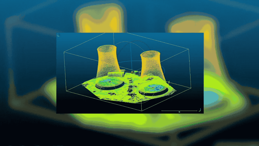
What is LiDAR Technology and How Does it Work?
LiDAR (Light Detection and Ranging) is a remote sensing technology that uses laser pulses to measure distances and create highly detailed 3D representations of the surveyed environment.
It works by emitting laser beams and measuring the time it takes for the pulses to bounce back after hitting objects in their path.
These measurements allow LiDAR sensors to capture precise distance and elevation data, enabling the creation of detailed point cloud models.
Advantages
Drones equipped with LiDAR technology offer several advantages for data collection and aerial mapping that includes:
- Highly Accurate Terrain Mapping: LiDAR enables the generation of highly accurate and detailed terrain maps by capturing millions of data points per second.
- Efficient Data Collection: LiDAR systems mounted on drones can cover large areas quickly and efficiently, eliminating the need for time-consuming and labour intensive manual surveying.
- Cost-Effective Solution: LiDAR technology reduces fieldwork and manpower requirements to deliver significant cost savings over traditional surveying methods.
- Penetrates Vegetation and Obstacles: LiDAR has the ability to penetrate dense vegetation and capture data from beneath the canopy. LiDAR can also penetrate through thin materials to capture details of the underlying structures.
- Enhanced Data Visualisation and Analysis: The point cloud data generated by LiDAR technology can be easily visualised, analysed, and processed using specialised software. This allows for detailed feature extraction, 3D modelling, and comprehensive analysis of captured data.
Use Cases and Applications
Built Environments
- Urban Planning and Development: LiDAR enables precise 3D mapping and modelling of urban areas. Supporting city planning, architectural design, and infrastructure development.
- Construction and Building Information Modelling (BIM): LiDAR assists in generating accurate as-built models, monitoring construction progress, and facilitating clash detection in BIM workflows.
- Heritage Documentation: LiDAR aids in preserving historical structures by creating detailed digital representations that assist with documentation, restoration, and conservation efforts.
Infrastructure
- Transportation and Road Networks: LiDAR-derived elevation data helps in designing transportation corridors, assessing road conditions, and planning infrastructure improvements.
- Bridge and Dam Inspection: LiDAR scanning provides detailed structural analysis of bridges and dams. Detecting deformations, erosion, and other potential issues for timely maintenance and safety assessment.
- Utility and Pipeline Management: LiDAR-equipped drones can quickly inspect power lines, pipelines, and other utility infrastructure. Identifying maintenance needs, detecting encroachments, and improving asset management.
Resources and Energy
- Oil and Gas Exploration: LiDAR technology aids in the identification of potential drilling locations, mapping offshore platforms, by assessing terrain conditions for safe and efficient energy exploration.
- Mining and Quarrying: LiDAR enables precise mapping and volumetric calculations of mining sites Optimising resource extraction, monitoring stockpiles, and assessing environmental impacts of mining operations.
- Renewable Energy: LiDAR facilitates site selection, wind resource assessment, and solar potential analysis for the development of wind farms and solar energy installations.
Natural Environments
- Environmental Monitoring: LiDAR data supports ecosystem monitoring, forest inventory, and wildlife habitat analysis. Aiding in biodiversity conservation, fire risk assessment, and effective land management.
- Coastal Zone Mapping: LiDAR scanning of coastal areas provides valuable data on shoreline erosion, coastal infrastructure planning, and coastal ecosystems to evaluate impacts of climate change.
- Floodplain Mapping: LiDAR surveys assist in floodplain mapping, flood risk assessment, and emergency response planning. Helping communities mitigate flood-related damages and improve disaster preparedness.
Government and Communities
- Disaster Management and Emergency Response: Drones equipped with LiDAR sensors can swiftly assess damage following natural disasters. They generate intricate 3D models that aid in search and rescue missions, evaluate infrastructure damage from an aerial perspective, and facilitate successful disaster recovery planning.
- Land Use Planning: LiDAR data is crucial for assessing the suitability of different areas for various land uses, such as residential, commercial, or agricultural purposes.
- Urban Security and Infrastructure Monitoring: LiDAR technology assists in urban security applications, including monitoring critical infrastructure, detecting changes in urban environments, and analysing potential risks.
LiDAR Data Processing, Analysis and Visualisation
Our expert team specialises in LiDAR data processing, meticulously cleaning and enhancing the data to ensure accuracy and reliability.
Using sophisticated algorithms and data processing techniques, we extract valuable information from the point cloud data, allowing for detailed analysis and actionable insights.
Through our advanced analysis, we can generate precise Digital Elevation Models (DEMs), contour maps, and 3D models that capture the intricate details of the surveyed area.
These outputs provide a comprehensive understanding of the terrain, allowing for informed decision-making and effective planning.