Aerial Data Capture
Achieve precise data collection for detailed analysis and informed decision-making with our advanced aerial data capture solutions.
Our Data Capture Capabilities
Aerial drones or Unmanned Aerial Vehicles (UAVs) have emerged as a vital tool for mapping, surveying, and inspecting various assets — offering significant advantages in terms of time, cost, and risk reduction.
As a leader in aerial technology and drone data capture operations, we offer state-of-the-art solutions that revolutionise the data collection process.
With our advanced AUV technology and wide range of aerial data capture solutions, you can unlock the full potential of aerial data to gain valuable insights that will help you make informed decisions.
Our experienced team and high-tech equipment ensures precise data collection for meticulous data processing and accurate analysis.
We are committed to delivering reliable aerial data, giving you the confidence to make critical decisions for your project.
Contact us today to explore how our tailored aerial data capture solutions can assist with your data capture needs.
Capabilities
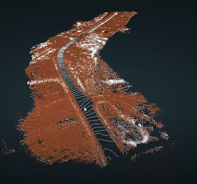
LiDAR
Aerial data collection with LiDAR (Light, Detection and Ranging) technology to precisely measure distances and obtain accurate spatial data.
Bathymetry
Specialised solutions for data collection, mapping, and surveying of submerged terrains, including oceans, rivers, lakes, and waterways.
Photogrammetry
Photogrammetry capabilities that allow for accurate assessments of distances, heights, volumes, and dimensions by creating detailed 3D models.
Restricted Access Inspections
Our RAI drones that facilitate safe, accurate, and efficient inspections of indoor and hazardous internal spaces without the need for human entry.
GPR
GPR (Ground Penetrating Radar) technology that enables non-destructive and accurate data collection to survey subsurface objects and underground structures.
Applications
Aerial Surveying
With our fleet of high-performance commercial drones and superior analytical capabilities, we are able to provide a wide range of aerial surveying and mapping solutions for the most challenging terrains and environments.
Asset Inspections & Audits
Our drones equipped with high-resolution imaging technology and sensors offer valuable insights on the condition, reliability, and functionality of important assets to ensure optimal operational efficiency.
Hazard Mapping
Combining UAV's with remote sensing technology and geospatial analysis, we have the ability to provide customized hazard mapping solutions that proactively safeguard against risks and provide invaluable foresight.
Natural Assets
We provide comprehensive aerial surveying and mapping solutions that enable detailed analysis of natural resources to support environmental monitoring, conservation efforts, and sustainable land management.
Safety & Emergency
From hazardous area inspections to search and rescue assistance, we leverage the power of unmanned aerial vehicles to support safety and emergency response operations all over the country.
Site Staging
We help optimize site staging activities with aerial surveying, precise data collection, and strategic planning to improve efficiency, accuracy, and safety measures for all types of construction and development projects.
Terrain Mapping
Our aerial surveying and terrain mapping capabilities with UAVs allow you to visualise the topography, elevation, and distinct features of surveyed land in unprecedented detail.
In a little more detail
Light Detection and Ranging (LiDAR) technology works by emitting laser pulses and measuring their reflected signals, capturing precise spatial information about terrains, buildings, and infrastructure.
It is widely used in industries such as construction, urban planning, and engineering for accurate measurements and assessments.
Thermal Imaging
Thermal imaging technology captures infrared radiation, allowing the visualisation of different heat patterns to detect temperature anomalies.
It can be used in various applications such as inspections, monitoring, risk assessments, and emergency response.
Multispectral Imaging
Drones with multispectral cameras capture images across multiple wavelengths of light.
By capturing information across multiple spectral bands, multispectral imaging is an effective method for assessing crop health, monitoring environmental conditions, analysing land resources, and conducting research in a diverse range of sectors.
Multispectral imaging is used in various applications including environmental monitoring, forestry, water quality assessment, archaeology, and environmental conservation.
Remote Sensing and Environmental Monitoring
Our drones that are equipped with sensors, such as gas analyzers and environmental monitoring devices, play a vital role in gathering accurate and real-time environmental data.
They have the ability to gather important data related to air quality, atmospheric conditions, water quality, and other environmental parameters.
This information can assist with environmental research, disaster management, and conservation efforts. And can be used in various applications such as assessing air quality in urban areas, monitoring the impact of industrial activities on ecosystems, or surveying natural habitats.
Geospatial Mapping and Surveying
With Global Navigation Satellite System (GNSS) receivers and onboard sensors, our drones provide precise geospatial mapping and surveying capabilities.
This ensures accurate data collection and allows for the creation of detailed topographic maps and 3D models.
Our aerial data capture solutions include sophisticated photogrammetry techniques and data processing technology.
This involves capturing a series of overlapping aerial images from various angles and meticulously processing these images to create highly accurate and detailed models of landscapes, structures, or assets.
Data Transmission and Storage
All of our drones are equipped with communication systems and onboard storage capabilities that allow for real-time data transmission to ground stations and cloud-based platforms.
This facilitates immediate access to captured data, efficient data management, faster analysis, and seamless collaboration among all stakeholders.
Having immediate access to captured data enhances decision-making processes, improves operational efficiency, and enables timely actions based on up-to-date information.
Achieve Precision in Data Capture and Extraction
Our diverse range of aerial data capture solutions enable you to collect data with unparalleled precision and efficiency.
From aerial surveys and mapping, to asset inspections and environmental monitoring, we guarantee accurate, reliable, and high-quality data acquisition at all times.
Actionable Insights for Informed Decisions
Data alone is powerful, but actionable insights drive success.
Our expert team combines analytical skills, data processing techniques, and industry experience to transform raw data into meaningful insights.
We’ll help you uncover patterns, identify trends, and make informed decisions that help you achieve your mission objectives.
Tailored Data Capture Solutions for Your Unique Needs
We understand that every situation is unique, and that’s why our data capture solutions are tailored to your specific needs.
Whether you require detailed measurements, comprehensive 3D models, or real-time monitoring, our flexible and scalable solutions are designed to meet your goals.