
Government & Community
Working Drones Australia is a leading provider of advanced drone services for the Government and Community sector.
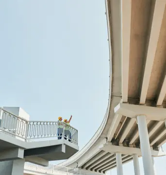
Our 24 hour challenge
We understand the unique needs and requirements of the Australian Government and Community sector and bring of wealth of industry-specific knowledge to the table.
With a proven track record of delivering optimal outcomes and unmatched service, we are on hand to help you see how and what drone technologies can help solve your particular project or challenge.
We pride ourselves on enabling government to make considered decisions and to maximise their investment into programs. That said, we are happy to provide our recommendations for your next project free of charge, and within 24 hours.
Simply complete the form below, providing as much detail as possible and we will come back to you with options and our recommendations.
Our Services
With our expertise and specialised unmanned aerial vehicles (UAVs) we offer a comprehensive range of services specifically tailored to meet the unique needs of Government and Community projects, including (but not limited to):
- Public infrastructure monitoring: Monitor the condition and maintenance needs of public infrastructure such as roads, bridges, dams, and utilities — enabling proactive maintenance planning and cost-effective asset management.
- Surveying and mapping for land management: Conduct precise aerial surveys and mapping for land management purposes, including land administration, cadastral mapping, boundary identification, and land-use planning.
- Heritage site documentation: Capture high-resolution aerial imagery and create detailed 3D models of heritage sites and landmarks to assist with documentation, preservation, and restoration efforts.
- Event management and crowd control: Deploy drones for event management and crowd control, providing real-time situational awareness, monitoring crowd movement, and enhancing safety measures during public gatherings and major events.
- Traffic monitoring and management: Observe traffic flow, detect congestion, and assess road conditions from an aerial perspective — facilitating data-driven traffic management strategies to improve transportation efficiency.
- Environmental impact assessment: Perform aerial assessments to monitor and evaluate the environmental impacts of infrastructure projects, land development, and public initiatives to ensure compliance with environmental regulations.
- Disaster recovery and damage assessment: Rapidly assess and document the extent of damage after natural disasters to provide accurate and timely information for efficient disaster recovery and insurance claim purposes.
- Search and rescue operations: Support search and rescue teams by deploying drones for aerial reconnaissance, thermal imaging, and live video feed to assist in locating missing persons and to provide critical information in emergency situations.
- Community engagement and outreach: Utilise drones as a tool for community engagement, capturing aerial footage and imagery for public outreach, education, and awareness campaigns.
- Data processing, analysis, visualisation, and reporting: Comprehensive data processing services to provide valuable information and actionable insights — including data analysis, data visualisation, advisory, and reporting.
Sector
Local Government
Slope stability assessment
Experience Summary
Local NSW government client required LiDAR data to understand the slope stability of a regional road that had collapsed after significant rain
What we did
Gathered data with TrueView 535 (LiDAR)
Produced a ground classified point cloud to remove vegetation and allow for flood plain analysis
- Produced a detailed orthomosaic
The Working Drones Australia Guarantee
Our commitment to customer satisfaction for clients in the Government and Community sector is what sets us apart from other UAV service providers. We prioritise open communication, transparency, and collaboration throughout the entire lifecycle of your projects.
Our dedicated team is always available to address concerns, answer questions, and provide ongoing support, ensuring a positive and seamless experience.
When you partner with Working Drones Australia, we guarantee:
- Extensive Industry Expertise: Our team consists of highly skilled professionals with a deep understanding of drone technology, regulations, and the unique challenges of the Government and Community sector.
- Cutting-Edge Equipment: We pride ourselves on using the most advanced drone equipment and analysis software available. Our state-of-the-art UAVs, sensors, imaging technologies, and software enable us to capture high-resolution data, perform precise inspections, and deliver exceptional results. We ensure superior performance and accuracy in all our operations.
- Safety First Approach: We strictly adhere to industry safety standards and regulations to ensure the well-being of our team, clients, and the general public. With our stringent safety protocols, detailed risk assessments, and meticulous planning processes, we ensure that every operation is conducted with the highest level of safety and compliance.
- Tailored Solutions: We understand that each client and project is unique. We take a personalised approach, working closely with you to understand your specific requirements and challenges. Our team develops customised solutions that address your individual needs to deliver results that exceed expectations.
- Comprehensive Services: We offer a wide range of services that go beyond standard drone operations. From aerial assessments and data collection, to mapping, surveying, analysis, advisory, and 3D modeling — our comprehensive suite of services provides a one-stop solution for all your drone and UAV needs.