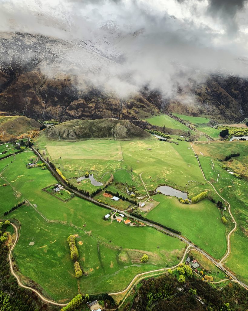
Photogrammetry
Learn more about our Photogrammetry solutions to capture precise aerial data for accurate 3D modelling and mapping.
With our photogrammetry capabilities, we can produce accurate and detailed 3D models for a diverse range of landscapes, terrains, and structures.
Our drones capture multiple images from different angles, enabling precise measurements of distances, heights, and dimensions.
Why Us?
With our innovative photogrammetry equipment and extensive experience with drone surveying operations, we have the ability to deliver desirable outcomes for clients across a diverse range of sectors.
Contact us today to discuss your unique project requirements and discover how we can help you achieve your project objectives.
How Does Photogrammetry Technology Work?
Photogrammetry is a technique that uses multiple images taken from different angles to create accurate 3D models, maps, and measurements of objects or landscapes.
The process involves capturing images, extracting key features, matching corresponding points, calibrating the camera, and reconstructing a 3D representation.
Through data processing and visualization, the 3D model is refined to generate extremely detailed outputs that include orthomosaic maps, point clouds, and textured 3D models.
Advantages
Drones equipped with Photogrammetry technology offer several advantages for data collection and aerial mapping that includes:
- High Precision and Accuracy: Photogrammetry enables the creation of highly accurate 3D models and maps. By meticulously capturing multiple images from different angles, photogrammetry can reconstruct the intricate details of real-world objects and surveyed areas.
- Efficient Data Capture: The use of drones with photogrammetry technology allows for rapid capture of precise aerial data over large areas in a shorter time-frame. This significantly reduces the costs associated with personnel, equipment, and logistical requirements for land-based surveying operations.
- Flexibility and Accessibility: Drones have the ability to capture accurate data in rugged terrains or inaccessible landscapes. The versatility of this approach facilitates extensive aerial mapping for a wide range of challenging environments.
- Data Integration: Photogrammetry outputs, such as orthomosaic maps, point clouds, and textured 3D models, can be seamlessly integrated with other geospatial data, such as LiDAR or GPS data. This integration enables comparative analysis, data fusion, and enhanced interpretation of the captured data.
Use Cases and Applications
Built Environments
- Construction Progress Monitoring: By capturing high-resolution images from different angles and viewpoints, photogrammetry provides an extensive visual record of the site’s development progress.
- Building Inspections and Maintenance: Drones with photogrammetry capabilities can capture high-resolution images for close examination of building components. This aids in identifying maintenance needs, detecting structural issues, and planning repairs or renovations.
- Remote Real Estate and Property Inspections: Photogrammetry in property development allows for the creation of immersive 3D models and virtual tours, offering potential buyers and investors a realistic perspective of the property. This enhances marketing, speeds up decision-making, and enables remote property assessments without the need for physical visits.
Infrastructure
- Planning of Infrastructure Projects: Photogrammetry empowers engineers and project managers to plan and optimize the layout of roads, bridges, pipelines, and utility networks with precision. By utilising detailed aerial imagery, accurate maps and detailed 3D models, they can make informed decisions regarding the design, alignment, and positioning of these important infrastructure elements.
- Bridge Inspection and Assessment: High-resolution imagery obtained through photogrammetry enables detailed inspections and accurate assessments of bridges without the need for manual access. This provides a more efficient, safe, and effective method to ensure structural integrity of the bridge.
- Monitoring and Surveillance: Photogrammetry technology offers numerous benefits for infrastructure monitoring. It enables accurate visual inspections, early issue detection, enhanced security surveillance, and reliable data for effective asset management.
Resources and Energy
- Environmental Monitoring and Conservation: Photogrammetry offers significant benefits for environmental monitoring and conservation. It provides researchers, conservationists, and decision-makers with valuable insights for identifying biodiversity hotspots, tracking habitat degradation, and implementing targeted conservation measures.
- Mining and Quarrying: By capturing high-resolution imagery and generating precise 3D models, photogrammetry helps mining companies optimize their operations, track the progress of excavation activities, and manage resources effectively.
- Renewable Energy Site Assessment: Drones equipped with photogrammetry technology are used to assess potential sites for renewable energy projects, such as solar or wind farms. By capturing detailed terrain data and analysing sunlight or wind patterns, drones with photogrammetry capabilities assist in site selection, layout optimisation, and energy yield estimations.
Natural Environments
- Ecological Surveys and Research: Photogrammetry is frequently used to survey ecosystems, collect data, and monitor biodiversity. The ability to create high-resolution maps, 3D models, and orthomosaics, supports species identification, habitat mapping, and ecological studies.
- Disaster Response and Assessment: In the aftermath of natural environmental disasters, drones with photogrammetry capabilities can accurately assess the extent of damages, generate detailed damage reports, and aid in disaster response planning.
- Coastal and Environmental Monitoring: Photogrammetry allows for the detailed monitoring of coastal areas to detect shoreline erosion and changes in land-water interfaces. Providing valuable insights for coastal management and preserving coastal ecosystems.
Government and Communities
- Urban Planning and Development: Photogrammetry is used to assist with urban planning processes. By capturing highly accurate aerial data and generating detailed 3D city models, it enables town planners to make informed decisions regarding infrastructure planning and zoning regulations.
- Emergency Response: In emergency situations, drones equipped with photogrammetry capabilities are invaluable for providing timely and accurate situational awareness. By providing valuable visual data from inaccessible or hazardous locations, drones enable rapid decision-making, facilitate targeted rescue efforts, and enhance overall emergency response coordination.
- Cultural Heritage Preservation: Accurate and detailed 3D models generated by photogrammetry enables experts to analyze and study historical structures, artifacts, and archaeological sites. This aids in the documentation and record-keeping of cultural heritage, and facilitates restoration planning and conservation efforts.
Photogrammetry Data Processing, Analysis and Visualisation
We have perfected a streamlined process to maximise the value of your aerial data using photogrammetry techniques.
Through meticulous data stitching, feature extraction, and rigorous quality control, we transform raw data into accurate and reliable outputs.
Whether it’s interactive 3D models, fly-through animations, or immersive virtual tours, our visualisations bring your data to life.
Our detailed visualisation materials allow for a better understanding of your captured data to facilitate informed decision-making and effective communication of key insights with stakeholders.