Bathymetry
Learn more about our specialised UAV bathymetry solutions for accurate surveying, data collection, and mapping for oceans, rivers, lakes, and waterways.
Our UAV bathymetry services are highly advanced, catering to the unique needs of data collection, mapping, and surveying of submerged terrains.
Whether it’s mapping the ocean floor, surveying riverbeds, or analysing lake topography, our expert approach enables us to deliver precise and detailed results.
Why Us?
Our extensive experience with UAV bathymetry technology ensures accurate data collection and comprehensive insights you can rely on.
Get in touch with us today to discuss your unique requirements and discover how our UAV bathymetry solutions can help you achieve your project objectives.
Sector
Local Government
Water Quality Assessment
Experience Summary
A local council required data collection to determine sedimentation levels in water quality ponds.
What we did
- Performed missions with dual frequency echosounder to gather data
- Processed data with Hydromagic
- Analysed sediment penetration differences with dual frequency
- Produced shape files and data files as deliverables
How Does UAV Bathymetry Work?
UAV bathymetry refers to the technique of mapping underwater environments using unmanned aerial vehicles (UAVs).
The drone hovers above the water surface and follows a predetermined flight path, systematically scanning the underwater area of interest with sensors specifically designed for underwater mapping, such as sonar or LiDAR (Light Detection and Ranging) technology.
These sensors emit signals or laser pulses that penetrate the water and bounce back when they encounter the seafloor or underwater objects.
By measuring the time it takes for the signals or pulses to return, the depth of the water and the shape of the underwater terrain can be determined.
The collected data is then processed and analysed to generate accurate underwater maps and other data visualisation materials.
Advantages
Drones equipped with bathymetry technology offer several advantages for data collection and underwater mapping that includes:
- Precision and Accuracy: UAV bathymetry captures precise data of submerged terrains, resulting in highly accurate underwater mapping for detailed analysis.
- Efficient Data Collection: UAV bathymetry provides enhanced efficiency in comparison to conventional underwater surveying techniques, as drones can survey larger areas in shorter timeframes to collect more data at a faster pace.
- Cost-Effectiveness: UAV bathymetry is a cost-effective solution for underwater mapping and data collection as it eliminates the need for expensive vessels to access submerged terrains.
- Enhanced Safety: UAV bathymetry minimises risks to personnel as drones can access hazardous or hard-to-reach areas, eliminating the need to physically enter dangerous environments.
- Flexibility and Accessibility: UAV bathymetry provides flexibility in accessing different underwater environments as drones can be deployed to survey various water bodies, including vast lakes, fast-flowing rivers and inaccessible coastal areas.
- Data Integration and Analysis: The data collected through UAV bathymetry can be integrated with other geospatial data and analysed using advanced software, allowing for comprehensive data analysis and detailed reporting for effective decision-making.
Use Cases and Applications
Built Environments
- Construction Site Monitoring: UAV bathymetry can be used to monitor construction sites near water bodies, providing accurate information about the water depths, sedimentation patterns, and potential underwater obstacles.
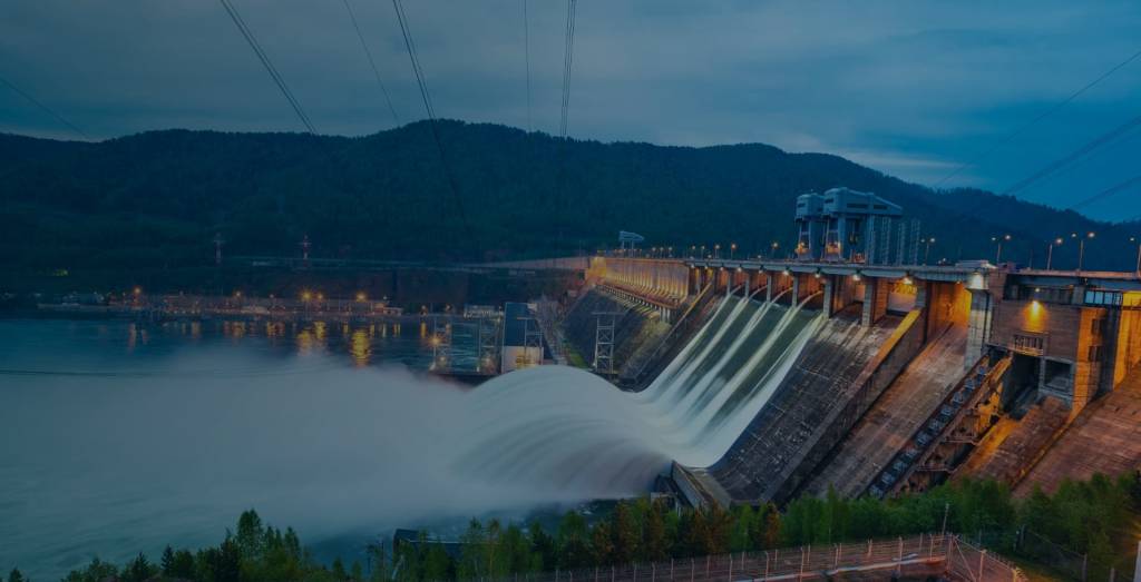
- Dam and Reservoir Management: UAV bathymetry can assist with monitoring the sedimentation levels in dams and reservoirs, detecting erosion or potential dam failure risks.
- Flood Risk Assessment: UAV bathymetry enables effective flood mitigation and urban planning processes by analysing riverbeds, drainage systems, and flood-prone zones.
Infrastructure
- Port and Harbour Management: UAV bathymetry can help facilitate safe navigation and efficient port operations by mapping underwater channels to detect submerged objects and ensure optimal water depth for vessel passage.
- Pipeline and Cable Routing: UAV bathymetry aids in the planning and installation of underwater pipelines and cables by providing accurate mapping of seabed conditions. Identifying suitable routes and ensuring the protection of existing infrastructure.
- Offshore Platform Monitoring: UAV bathymetry supports the monitoring of offshore platforms by mapping the surrounding underwater environment to detect changes in seabed conditions.
Resources and Energy
- Offshore Wind Farm Planning: UAV bathymetry plays a crucial role in the planning and development of offshore wind farms by providing precise data on seabed conditions, particularly for identifying optimal locations for turbine foundations.
- Oil and Gas Exploration: UAV bathymetry assists in offshore oil and gas exploration by conducting detailed mapping of underwater geological formations and contributing to accurate resource estimation.
- Environmental Impact Assessment: UAV bathymetry provides informative insights related to the impact of resource and energy extraction activities on underwater ecosystems. Supporting sustainable resource management and minimising environmental disturbances.
Natural Environments
- Coastal Zone Management: UAV bathymetry contributes to coastal zone management by mapping shoreline changes and monitoring erosion and sedimentation patterns. This supports sustainable coastal development and preservation of valuable coastal ecosystems.
- Wetland Conservation: UAV bathymetry is utilised for wetland conservation by mapping wetland boundaries, assessing hydrological dynamics, and monitoring changes in water levels and vegetation distribution.
- Marine Ecology Research: UAV bathymetry enhances marine ecology research by conducting detailed mapping of underwater habitats, studying marine biodiversity, and monitoring the health and resilience of marine ecosystems.
Government and Communities
- Search and Rescue Operations: UAV bathymetry is used to assist with search and rescue operations in water bodies by mapping underwater terrains, detecting submerged objects, and locating missing persons.
- Environmental Monitoring and Pollution Detection: UAV bathymetry enables accurate data collection to monitor water quality, detect pollution sources, and assess the impact of human activities on aquatic environments.
- Community Awareness and Education: UAV bathymetry can be used to create visual representations and educational materials about underwater environments. Promoting community awareness and understanding of the importance of underwater ecosystems.
UAV Bathymetry Data Processing, Analysis and Visualisation
Our UAV bathymetry solutions not only capture accurate underwater data, we also provide comprehensive data processing, analysis, and visualisation services to unlock valuable insights for your project.
We provide you with high-resolution point clouds, Digital Elevation Models (DEMs), 3D visualisations, volume calculations, and customised reports to maximise the full potential of your captured data.